Product details
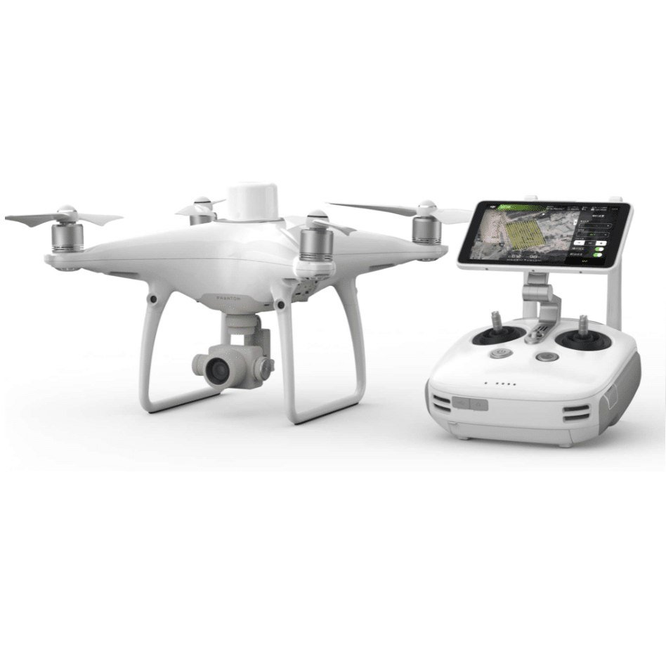
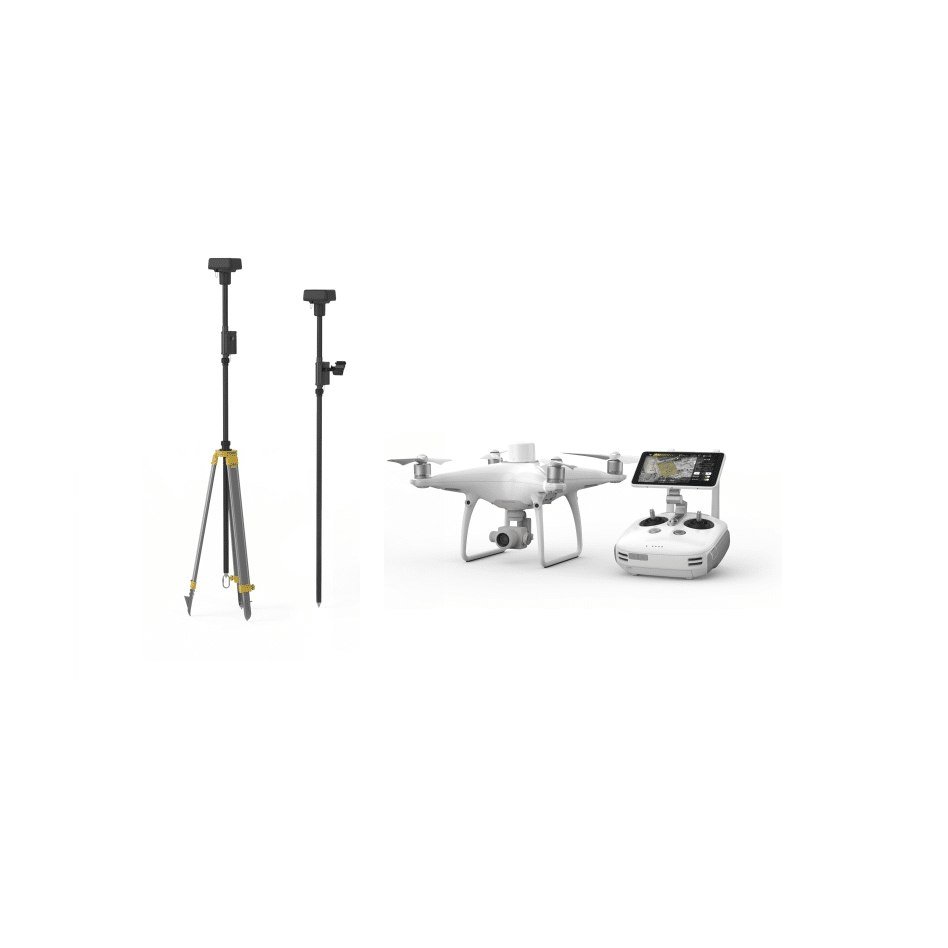
DJI Phantom 4 RTK & D-RTK Ground Station Bundle
Overview: The DJI Phantom 4 RTK & D-RTK Ground Station Bundle is designed for precision and accuracy in surveying, mapping, and inspection workflows. This bundle includes the DJI Phantom 4 RTK drone and the D-RTK 2 Mobile Station, providing a comprehensive solution for obtaining centimeter-level positioning data in real-time.
Key Features:
- RTK Module:
- Integrated RTK module provides real-time, centimeter-level positioning data.
- Redundant GNSS module enhances flight stability in signal-poor regions.
- Optimizes flight safety and ensures precise data capture.
- TimeSync System:
- Aligns the flight controller, camera, and RTK module.
- Ensures accurate metadata and fixes positioning data to the center of the CMOS.
- Optimizes photogrammetric results.
- Imaging System:
- 1-inch, 20-megapixel CMOS sensor.
- Mechanical shutter prevents rolling shutter blur.
- Achieves a Ground Sample Distance (GSD) of 2.74 cm at 100 meters flight altitude.
- Rigorous camera lens calibration for unparalleled accuracy.
- Flight Planning Application:
- GS RTK app with Photogrammetry and Waypoint Flight modes.
- Allows selection of flight paths, adjustment of overlap rate, altitude, speed, and camera parameters.
- Features direct loading of KML area files, shutter priority mode, and strong wind alarm.
- Mobile SDK Supported:
- Compatible with DJI Mobile SDK for automation and customization through a mobile device.
- OcuSync Transmission System:
- Stable HD image and video transmission up to 7 km.
- Great for mapping larger sites.
D-RTK 2 Mobile Station:
- High-Precision GNSS Receiver:
- Supports GPS, GLONASS, Beidou, and GALILEO signals.
- Provides real-time differential data for centimeter-level positioning accuracy.
- High-gain antenna for better signal reception.
- Connectivity:
- Supports 4G, OcuSync, WiFi, and LAN communication.
- Up to 5 remote controllers can connect simultaneously for coordinated operations.
- Durability:
- IP67 level ingress protection and lightweight carbon fiber body.
- Built-in IMUs monitor movements and calibrate tilt sensors to minimize risks.
Applications:
- Ideal for surveying, aerial inspections, agriculture, and other applications requiring high precision.


Charlie H Austin –
The DJI Phantom 4 RTK provides remarkable accuracy for surveying.
Daniel Daniella –
The centimeter-level positioning data is invaluable for my mapping projects.
Barnes Parson –
This bundle includes everything I need for aerial inspections.
Hannah Scarlet –
The D-RTK Ground Station enhances my workflow significantly.
Aaron Jameson –
Setting up the Phantom 4 RTK was straightforward.
Keats Alwin –
I appreciate how quick it is to get started with my projects.
Yosef Phillip –
The 20-megapixel camera captures stunning detail.
Sarah Joyce –
My aerial photos have never looked better, thanks to this drone’s imaging system.
Kingy Denis –
I’ve used it in various conditions, and it consistently performs well.
Mary –
The flight stability is impressive, even in challenging environments.
Ian John –
This drone is a game changer for professionals in surveying and mapping.
Phoebe Layla –
It meets all my needs for precision and reliability.
Facundo Elly –
The integrated RTK module is fantastic for real-time data collection
Sarah Joyce –
It adds immense value to my surveying tasks.
Eaton John –
The GS RTK app allows for precise flight planning
Iscah Paulene –
Adjusting parameters is easy, making my flights more efficient.
Oliver Drean –
The drone offers substantial flight time, allowing me to cover large areas without interruptions
Oliver Drean –
It’s perfect for extensive surveys.
Lovinia Jose –
The carbon fiber body is both lightweight and robust.
Mercy May –
I feel confident using it in various environments without worry.
Miller Metrovioc –
The high-precision GNSS receiver ensures accurate data collection.
Gordon Mikaael –
It’s a vital feature for my surveying needs.
Taban Misy –
The connectivity options are excellent.
Dancun Zigler –
I appreciate being able to connect multiple remote controllers for coordinated operations.
Ashley J Lisa –
This bundle helps streamline my data collection process
Katy Amelia –
Real-time feedback significantly improves my project efficiency.
Lavender Lyne –
Ideal for different applications, from agriculture to inspections
Sar Ellison –
This drone adapts well to various industries and tasks.
Ibrahim Ares –
The high-gain antenna provides reliable signal reception.
Uriel Rodrigo –
I’ve experienced minimal connectivity issues, which is crucial for my work.
Lilian Harvey –
The mechanical shutter eliminates rolling shutter blur, resulting in smooth, high-quality footage
Maya –
This is essential for my video projects.
Van Der –
The TimeSync system ensures accurate metadata for each image.
Liam Bethwel –
This feature is vital for my mapping accuracy.
Logan Billy Gabriel –
The drone is compact and easy to transport
Benjamin James –
I can take it anywhere without hassle, making it ideal for fieldwork.
Alpha Dorice –
The combination of RTK and D-RTK technology provides unparalleled precision.
Layla Mava –
This innovation significantly enhances my surveying capabilities.
Joan Scott –
I’ve used it for mapping large sites, and the results are impressive.
Samantha Jennifer –
The accuracy is unmatched compared to other drones I’ve tried.
Linda –
The redundant GNSS module enhances flight stability in signal-poor areas.
Keats Alwin –
This feature has been a lifesaver during challenging flights.
Daniel Carter –
It allows for detailed imagery that meets my professional standards.
Sar Ellison –
Achieving a GSD of 2.74 cm at 100 meters is remarkable.
Irine Clea –
The flight safety features provide peace of mind while operating.